The Swiss Path around Lake Uri: 35km in short lakeside stages
How long is the Swiss Path and can it be walked in short stages?
The Weg der Schweiz (Swiss Path) runs about 35km around the southern shore of Lake Uri, from the Rütli meadow to Flüelen. It is signed and split by cantonal sections, so most people walk it in three or four half-day stages over separate trips, using the lake steamers to start and finish each leg.
Most visitors see the southern arm of Lake Lucerne, the narrower stretch officially called Lake Uri, only from the deck of a steamer on the way to somewhere else. That is a shame, because a signed footpath runs almost the entire way around it, and it happens to be the most symbolically loaded trail in the country. The Weg der Schweiz, usually translated as the Swiss Path, was built for the 700th anniversary of the Swiss Confederation in 1991 and traces the shore from the Rütli meadow, where the founding oath is traditionally said to have been sworn, round to Flüelen. It is roughly 35km long, signed throughout, and deliberately built for public transport rather than a car park at either end.
This guide covers the route stage by stage, focuses on the Rütli-to-Bauen section that carries most of the history and most of the views, and sets out how to chain a stage or two together with the Lake Lucerne paddle steamers so you are not stuck walking back the way you came.
What the Swiss Path actually is
The route was split into 26 sections when it was built, one for each canton and half-canton, with each section’s length roughly proportional to the year its canton joined the Confederation. It is a nice idea on paper and mostly invisible on the ground today; what you actually experience is a single continuous yellow-signed trail with the usual Swiss hiking waymarks, hugging the western and southern shore of the lake between Rütli and Flüelen.
Two things distinguish it from a generic lakeside path. First, the terrain is not flat. The lake sits in a glacial trough with steep walls, so several stretches climb well above the water on old paths and forest tracks before dropping back to shore, meaning the total ascent over the full route adds up to more than 1,000 metres even though you start and finish near lake level. Second, almost nothing about it depends on a car. Every realistic start or end point is a boat pier or a railway station on the line between Lucerne and Flüelen, which is what makes it practical to do as a series of separate half-days rather than one long slog.
The route stage by stage
| Stage | Distance | Walking time | Terrain |
|---|---|---|---|
| Rütli to Bauen | 8km | 2.5-3 hours | Forest path, one steep climb near Seelisberg, then a long gentle descent |
| Bauen to Isleten/Sisikon | 6km | 2 hours | Mostly level lakeside path, a short exposed rock section |
| Sisikon to Flüelen | 8km | 2.5-3 hours | Climbs above the Axenstrasse road, some narrow ledges, then descends to Flüelen |
| Brunnen to Sisikon (alternative start) | 7km | 2 hours | Easier promenade-style path, good for a shorter first outing |
These figures assume a steady pace with normal photo stops, not a run. None of the stages require technical scrambling, but the Sisikon-to-Flüelen leg in particular has short sections cut into the rock above the road with a cable handrail, which is enough to rule it out for anyone uneasy with exposure or travelling with small children.
Almost nobody who is not attempting the whole thing in one trip needs to walk every stage. The two that reward the effort most are Rütli to Bauen, for the history and the views back across the lake to Seelisberg, and Brunnen to Sisikon, for an easier half-day that still delivers proper lake scenery without the steep climbs.
The Rütli stretch in detail
Rütli itself is a sloped meadow on the lake shore, reachable only by boat from Flüelen, Brunnen or Beckenried, or by a steep path down from Seelisberg above. There is a small visitor building and a flagpole; it is deliberately underdeveloped, since the site’s significance is historical rather than scenic. Most Swiss school groups visit at some point, and on national days it draws crowds, but on an ordinary weekday it is quiet.
From Rütli the path climbs steadily through forest towards Seelisberg, gaining around 200 metres over the first hour, before levelling out and eventually dropping back to the lake at Bauen. The climb is the hardest sustained section on the whole route but it is also the most rewarded, since the trees open onto repeated views down the length of the lake towards Brunnen and across to the cliffs of the Axen ridge on the far shore.
Bauen itself is a small, quiet lakeside village with a pier, a couple of guesthouses, and little else, which is exactly why it works well as a stopping point: it is easy to end a walk there and catch a boat onward or back rather than needing to push further.
Combining the walk with the boat
The steamer timetable on this stretch of the lake is not dense, particularly outside the main summer season, so the sensible way to plan is to fix your walking stage first and then check the return sailing rather than the other way round. Rütli, Bauen, Isleten, Sisikon and Flüelen all have a pier; Sisikon and Flüelen also sit on the Lucerne-Flüelen railway line, so those two points offer a train alternative if the boat timing does not work.
A typical plan for the Rütli-to-Bauen stretch: take an early boat from Brunnen or Flüelen to Rütli, walk the roughly three hours to Bauen, then catch an afternoon steamer back. Because sailings thin out later in the day, it is worth checking the current timetable before setting off rather than assuming an evening boat will be there; the practicalities of reading that timetable are covered separately in the guide to Lucerne’s boat timetables.
For visitors who would rather not plan the boat connections themselves, a guided option covers the practical side of a lake-and-hike day:
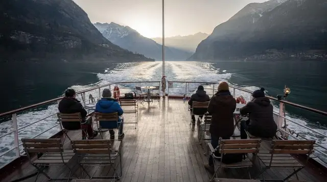
a return cruise on Lake Uri between Brunnen and Flüelen gives a full loop of the water the trail follows, useful either as a reconnaissance run before walking a stage or as an alternative on a day when the weather rules out the exposed sections.
Getting to the trailheads
Brunnen and Flüelen are both reachable from Lucerne by direct train in around 40 to 55 minutes, run by SBB/CFF on the Gotthard line, with departures roughly every half hour on weekdays. Sisikon also sits on this line. Rütli and Bauen have no road or rail access and depend entirely on the boat, which is the one genuine planning constraint on this route: miss the last sailing from Rütli and the only way out is the steep path up to Seelisberg and a bus from there.
| Trailhead | How to reach it from Lucerne | Approx. time |
|---|---|---|
| Brunnen | Direct train | 40 min |
| Sisikon | Direct train | 50 min |
| Flüelen | Direct train | 55 min |
| Bauen | Train to Flüelen/Brunnen, then boat | 1.5-2 hours |
| Rütli | Train to Flüelen/Brunnen, then boat | 1.5-2 hours |
A Swiss Travel Pass covers both the train and the regular boat sailings, which matters here more than on most day trips, because a Rütli-to-Bauen outing alone typically involves one train and two boat legs. The pass is covered in full in the Swiss Travel Pass guide; the regional Tell-Pass is worth comparing too, since it covers boats and several mountain lifts specifically within central Switzerland and can work out cheaper for a trip that does not otherwise need the Swiss Travel Pass’s national rail coverage.
Difficulty, waymarking and what to expect underfoot
The trail is signed with the standard Swiss yellow diamond markers, with a handful of stretches marked as mountain path (white-red-white) rather than the easier hiking path (yellow) waymark, mainly above Sisikon and on the climb out of Rütli. That distinction matters: white-red-white sections assume sturdy footwear and a reasonable head for narrow ground, even where no scrambling is involved.
Underfoot conditions vary a lot by stage. The lower sections near Bauen, Isleten and Brunnen are mostly good gravel or paved path close to the water. Higher sections above Sisikon are narrower forest and rock paths that can be slippery after rain and hold shade, and therefore ice, into spring. None of the route is glacier or high-alpine terrain, so it does not need specialist equipment, but it is not a paved lakeside promenade either, and trainers are a poor choice for the Rütli or Sisikon sections.
For a broader view of what else is walkable within range of the city, the guide to the best hikes near Lucerne sets this route alongside gentler and tougher alternatives, and the nature and hiking category lists other trails around the wider lake.
When to go
| Season | Conditions | Notes |
|---|---|---|
| Late April-May | Lower sections clear, upper shaded sections can still hold ice | Check conditions before attempting Sisikon-Flüelen |
| June-August | Fully open, warmest, busiest boats | Book early sailings to avoid the midday rush on the steamers |
| September-October | Reliable underfoot, cooler, fewer crowds | The best overall window for this route |
| November-March | Boat timetable thins sharply, short daylight | Stick to Brunnen-Sisikon or skip Rütli-Bauen until spring |
Autumn is the strongest recommendation here: the boat services still run a reasonable schedule, the forest sections are at their best, and the crowds thin considerably compared with a July weekend. Details on what to expect month by month are in the Lucerne weather guide, and general seasonal planning is covered in the best time to visit Lucerne.
What to bring
- Proper walking shoes with grip, not trainers, particularly for any stage above Sisikon or the Rütli climb.
- Water and food for any leg that includes Rütli, since there is nothing to buy there or on the climb up to Seelisberg.
- A layer for the boat crossings, which are noticeably cooler than the trail itself even in summer.
- A charged phone with the current boat timetable saved, since signal is patchy in the forested sections and the timetable changes by season.
- Trekking poles are useful but not essential on the steeper descents into Bauen and Flüelen.
Anyone planning to combine a stage of the Swiss Path with a bigger day in the hills should look at the full-day guided hiking option that pairs a lakeside walk with a higher route, or consider:
a full-day guided hike through the Alps and along the lake with pick-up included, which removes the timetable planning for visitors who would rather not manage boats and trains themselves on a single trip.
Suggested one-day plans
A realistic single day from Lucerne, rather than the full multi-day route, usually means picking one of these:
- Rütli to Bauen, the classic and most scenic half, roughly 6-7 hours door to door from Lucerne including the boats.
- Brunnen to Sisikon, an easier half-day with less climbing, good as a first outing or with older children.
- A there-and-back from Bauen, walking part way towards Rütli and returning to the same pier, useful if the boat timetable does not line up for a one-way finish.
For those who prefer a guided ridge walk with lake views rather than the shoreline path itself, a guided day hike along the ridges above Lake Lucerne covers similar scenery from higher up, which suits anyone who wants the views without the lakeside route’s exposed sections.
Visitors building a longer stay around this kind of walking day should look at the five-day summer Alps itinerary, which slots a lake walk in alongside mountain excursions, or the day trips from Lucerne guide for how this fits against other options like Rigi or the Jungfraujoch.
Combining with other transport passes
Because the whole route depends on boats and trains rather than a car, it is worth deciding on a pass before setting out rather than buying single tickets stage by stage, which adds up quickly on the lake steamers in particular.
the all-in-one Swiss travel pass covering trains, buses and boats is the simplest way to cover a multi-stage attempt at the Swiss Path without working out fares for each leg separately, and it also covers the wider Lake Lucerne boat network if the plan changes on the day. For a shorter one-off outing, a same-day Saver Day Pass or the regional Tell-Pass, described in the Tell-Pass guide, can work out cheaper than the multi-day Swiss Travel Pass.
Alternatives if the trail is not for you
Not every visitor wants a half-day of climbing on narrow forest paths. For a lower-effort way to see the same water, a private cruise on Lake Lucerne covers the scenery without the walking, and the Lake Uri cruise between Brunnen and Flüelen linked above gives the same view from the water in a couple of hours rather than a full day on foot. Cyclists have an option too, since parts of the shore are covered by the route described in the cycling and e-bike guide around Lake Lucerne, though the steepest sections of the Swiss Path are walking-only paths rather than bike-legal tracks.
For hikers wanting more of a challenge than the lakeside stages offer, the via ferrata and climbing guide for central Switzerland lists routes nearby with genuinely technical terrain, which the Swiss Path itself, despite its exposed stretches, does not require.
Lake cruises & boat tours on GetYourGuide
Verified deep-linked GetYourGuide tours. Book through these links and we earn a small commission at no cost to you.
GetYourGuide does not provide a product photo for this activity — the image shows the meeting point, photographed by us.