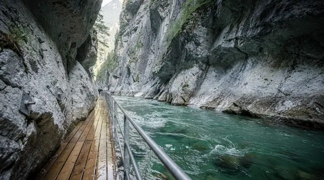
Best hikes near Lucerne: Rigi, Pilatus, Bürgenstock and more
What is the best day hike near Lucerne?
The Rigi ridge walk between Rigi Kulm and Rigi Scheidegg is the best all-round choice: wide lake views, a cogwheel train at each end, and no technical ground. The Bürgenstock cliff path and the lakeside Waldstätterweg are shorter and easier; the Pilatus ridge and Fronalpstock are steeper and better for confident walkers.
Five ridges, one lake — how to choose
Lucerne sits at the bottom of a lake surrounded by mountains that are all reachable by train, cable car or boat within an hour or two, which makes it an unusually easy base for day hiking without a car. The five routes below cover the range you’ll actually want to choose between: a long ridge walk with big views (Rigi), a steeper loop with a famous cogwheel descent (Pilatus), a short cliff path that suits almost anyone (Bürgenstock), a genuine mountain trail for fitter walkers (Fronalpstock above Stoos), and a flat lakeside path when you want scenery without the climb (the Waldstätterweg).
None of them require technical skill or gear beyond decent boots, but they’re not equally easy, and picking the wrong one for your fitness or your weather window is the main way a day like this goes wrong.
For orientation before you pick a trail, see the destination pages for Mount Rigi, Mount Pilatus, Bürgenstock and Stoos and Fronalpstock — each covers the railway or cable car that gets you there. This guide focuses on what happens once you’re on foot.
| Trail | Distance | Ascent/descent | Walking time | Difficulty |
|---|---|---|---|---|
| Rigi Kulm–Scheidegg ridge | 9 km | 200 m / 550 m | 3–3.5 hrs | Moderate |
| Pilatus ridge loop | 7 km | 450 m / 450 m | 3–4 hrs | Moderate–hard |
| Bürgenstock cliff path (Felsenweg) | 1.5 km | minimal | 45 min | Easy |
| Fronalpstock ridge | 8 km | 500 m / 900 m | 4–5 hrs | Hard |
| Waldstätterweg (Weggis section) | 6 km | 100 m / 100 m | 1.5–2 hrs | Easy |
The Rigi ridge walk: from Rigi Kulm to Rigi Scheidegg
Rigi is the “Queen of the Mountains” by nineteenth-century reputation, and the ridge walk from the summit at Rigi Kulm (1,798 m) down to Rigi Scheidegg is still the best introduction to Alpine walking within striking distance of Lucerne. You go up by cogwheel train from either Vitznau or Arth-Goldau, walk the open ridge south, and come down again by a different line or cable car, so it’s a genuine point-to-point rather than an out-and-back.
The path itself is wide, well-signed and mostly gentle — this is a ridge walk, not a scramble — with Lake Lucerne on one side and Lake Zug on the other for most of the way. Allow 3 to 3.5 hours of actual walking, plus time for the Kulm viewpoint and lunch at one of the mountain restaurants along the route (a plate of rösti with a fried egg runs CHF 22–28, which is normal for altitude in Switzerland rather than a tourist markup).
The full guide, including which station to start and end at, is at the Rigi guide; for the return transport, a day trip that pairs the Rigi cogwheel train with a lake cruise back to Lucerne removes the timetable-juggling if you’d rather not plan the connections yourself.
If you want the walking led rather than self-guided, a guided day hike along the ridge above the lake covers pacing, local plant and history commentary, and photo stops that are easy to rush past on your own.
The Pilatus ridge loop: steeper, shorter, more dramatic
Pilatus is the mountain that actually looms over Lucerne, and the walk here is more of a proper hike than the Rigi ridge — steeper both up and down, with rockier ground near the summit ridge. Most people take the cable car from Kriens (running all year) or the world’s steepest cogwheel railway from Alpnachstad (48% gradient, open roughly May to November depending on snow) up to Pilatus Kulm, then walk the ridge path toward Fräkmüntegg before descending by the Dragon Ride gondola or on foot.
Budget 3 to 4 hours of walking and treat the exposed sections near the top with respect in wind or rain — this is where Pilatus punishes overconfidence, not on the easier lower paths. The full route breakdown, including which combination of cable car and cogwheel train works best depending on the season, is at the Pilatus guide. If you’re deciding between Pilatus and Rigi for a single day, the comparison at Pilatus vs Rigi vs Titlis lays out the trade-offs directly.
The Bürgenstock cliff path: the easiest view in this list
The Felsenweg, or cliff path, runs along the flank of the Bürgenstock ridge above the lake and is the shortest, flattest walk here — 1.5 km, about 45 minutes, and suitable in trainers rather than boots. It’s not a substitute for the harder hikes, but it delivers a genuinely dramatic view (you’re walking along a rock face several hundred metres above the water) for almost no physical effort, which makes it the right choice on a short afternoon, with children, or after a heavier hike earlier in the day.
Reach Bürgenstock by funicular from Kehrsiten-Bürgenstock (itself reached by boat from Lucerne), and combine the cliff path with a ride on the Hammetschwand lift, Europe’s highest exterior lift, for an extra CHF 10 or so. Full details are at the Bürgenstock and Hammetschwand guide. For a version with commentary and no route-planning of your own, a private guided trip along the cliff path handles the boat and funicular connections as well as the walk.
Fronalpstock: the hardest walk on this list, and the best-kept secret
Fronalpstock sits above Stoos, reached from Schwyz by the funicular that claims the title of the world’s steepest at 110% gradient. The ridge walk from the top station is genuinely demanding: 500 m of ascent, close to 900 m of descent if you walk down rather than ride back, and stretches near the ridge where a fall would matter, so this isn’t the hike to attempt in poor visibility or with unsuitable footwear.
What you get for the effort is a view that most visitors to the Lucerne area never see, because Stoos gets a fraction of the traffic that Rigi and Pilatus do. Allow 4 to 5 hours, start early, and check the funicular’s operating calendar before you go, since like most of these railways it closes for maintenance in spring and again in autumn.
Route notes are at the Stoos and Fronalpstock guide, and Brunnen and Lake Uri covers the wider area if you want to extend the day. Walkers who’d rather have this kind of terrain led by someone who knows the ground can look at a private hiking day out from Lucerne toward the Engelberg valley, a comparable step up in difficulty from the ridge walks above.
The Waldstätterweg: lakeside walking without a mountain
Not every good walk near Lucerne involves a summit. The Waldstätterweg is a long-distance path that traces the shoreline of Lake Lucerne, and the section between Weggis and Vitznau — about 6 km, largely flat, 1.5 to 2 hours — is the easiest way to spend a morning outdoors without committing to a mountain railway or a steep climb. You walk through lakeside villages and orchard terraces with the water on one side and the Rigi massif rising on the other, and you can stop for a swim in summer where the path meets a public bathing spot.
This is the hike to pick on a day when the higher peaks are in cloud (a common Lucerne problem — check the webcams before you commit to a cable car ticket) or when you’re travelling with people who don’t want a strenuous day. Full route notes are at the Waldstätterweg lake trail guide, and Weggis and Vitznau covers where to eat and stay along the way.
Getting there, passes and timing
All five trailheads are reachable from Lucerne Bahnhof by a combination of train, boat and cable car, and the connections are covered in detail on each destination page rather than repeated here. Two passes matter for cost planning: the Swiss Travel Pass covers most trains, the regular lake boats and many mountain railways at no extra charge, while the regional Tell-Pass is usually the better deal if you’re staying in central Switzerland for several days and plan to ride more than one or two mountain railways, since it bundles most of them together at a flat rate.
Without either pass, a return cogwheel ticket to Rigi Kulm or Pilatus Kulm runs roughly CHF 75–90 per adult, which changes the maths considerably if you’re doing two or three of these hikes in a week.
If you’re piecing together boat timetables around a hike — say, walking the Waldstätterweg one way and taking the boat back — the boat timetables guide is worth five minutes before you leave the hotel, because the paddle steamers and regular boats don’t run on a single unified schedule and the gaps between departures can be over an hour outside peak season.
The single biggest way people ruin one of these days is timing: all of the cable cars and cogwheel railways above close for scheduled maintenance, typically for two to four weeks in spring (April) and again in autumn (November), and the exact dates move year to year. Check the specific railway’s own site for your travel dates rather than assuming a route that was open last year is open now — this is the mistake that strands more visitors at a closed base station than bad weather does.
For a broader view of which excursions suit which season, best mountain excursions from Lucerne and Lucerne weather month by month are useful companion reads, and if you’re building hiking into a longer stay, the 5-day itinerary has room for two of these routes without feeling rushed.
Whichever trail you pick, wear proper boots for anything beyond the Bürgenstock cliff path or the Waldstätterweg, carry a waterproof layer even on a clear morning — weather above 1,500 m changes faster than it does at lake level — and bring cash or a card, since mountain restaurants along these routes don’t always take contactless payment reliably at altitude.
Questions about hiking near Lucerne
Do I need hiking boots for these trails?
For the Rigi ridge, Pilatus loop and Fronalpstock, yes — proper hiking boots with ankle support and grip. The Bürgenstock cliff path and the Waldstätterweg are mostly gravel and boardwalk, so sturdy trainers are usually enough in dry weather.
Are these hikes covered by the Swiss Travel Pass?
The trains, cable cars and boats that get you to and from the trailheads are covered by the Swiss Travel Pass, including the Rigi and Pilatus cogwheel railways and the Lake Lucerne boats. The walking itself is free; you’re only paying for the transport.
When do the mountain railways close for maintenance?
Most cable cars and cogwheel trains around Lucerne close for a few weeks in spring (typically April) and again in November for annual revision. Always check the specific railway’s schedule for your travel dates rather than assuming a route is open.
Can I do a Lucerne mountain hike in one day without a car?
Yes. All five hikes in this guide start and end at a train, boat or cable car station reachable from Lucerne Bahnhof, and most round trips fit comfortably into a single day including travel time.
Which hike is best for children?
The Bürgenstock cliff path and the lakeside Waldstätterweg are the easiest with kids, both largely flat or gently graded. The Rigi ridge is manageable for older children used to walking; Pilatus and Fronalpstock involve steeper, longer ascents better suited to teenagers and adults.
Is the Fronalpstock hike difficult?
It’s the most demanding of the five: a genuine mountain trail with sustained ascent and some exposed sections near the ridge. Fitness and a head for heights matter more here than on the other routes, and the Stoos funicular approach is itself the world’s steepest.
What should I pack for a day hike from Lucerne?
Layers, a waterproof shell, sun protection, at least a litre of water, and cash or a card for mountain restaurants that don’t always take contactless. Weather changes fast above 1,500 metres even when Lucerne itself is warm and clear.
Hiking & nature tours on GetYourGuide
Verified deep-linked GetYourGuide tours. Book through these links and we earn a small commission at no cost to you.
GetYourGuide does not provide a product photo for this activity — the image shows the meeting point, photographed by us.